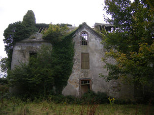
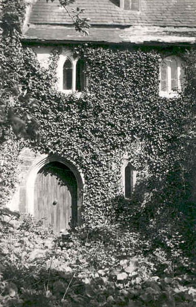
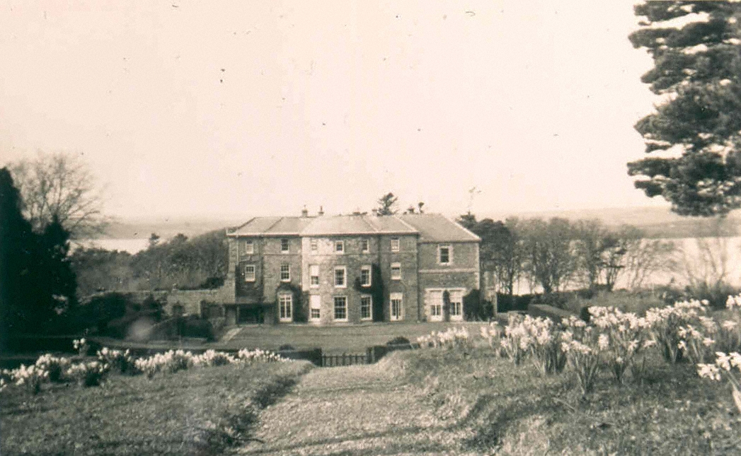
Shanagolden House
Houses within 5km of this house
Displaying 8 houses.
Houses within 5km of Shanagolden House
Displaying 8 houses.
| House name | Description | |
|---|---|---|
| Ballysteen | Inhabited by James Massey in the early 1850s who held the property from the Earl of Clare. The house was valued at £11+ at that time. Though still extant it has fallen into disuse. |

|
| Movena | A house on the Roche estate occupied by Bridget Farrell in the early 1850s when the buildings were valued at £11. Movena is marked on the first edition Ordnance Survey map. It is now a ruin. |
|
| Waterpark House | A house on the Monteagle estate, the residence of Catherine Nolan in the early 1850s, when it was valued at £10. It is labelled as Waterpark House on the 25-inch Ordnance Survey map of the 1890s. A house is still extant at the site. | |
| Corgrig House | Gerald Griffin was the proprietor of Corgrig in 1826, Mrs Griffin occupied Congrieff in 1837 and Gerald Griffin held Corgrig from Lord Monteagle in the early 1850s. The Ordnance Field Name Books state that Peter Griffin was the proprietor circa 1840 and that his father had erected this house about 80 years previously. It is still extant though with modern housing now occupying much of the surrounding area. The 25-inch Ordnance Survey map of the 1890s also shows a house known as Corgrig Lodge in the same townland at R253511. | |
| Old Abbey | The home of the Greene family for most of the 18th century. In 1786 Wilson refers to "Abbey" as the seat of Mr. Greene. Subsequent tenants were the Hodges and the Morgans. The Ordnance Field Name Books state that part of the building was very ancient and that a new front had been built in 1805. George Morgan was resident in 1814, William Morgan in 1837 and in the early 1850s, when he held the property from the Earl of Cork. Old Abbey passed to Willliam's daughter, Mrs Wardell, and stayed in the possession of the Wardell family into the 20th century. It is no longer extant. |
|
| Mount Trenchard | Lewis described this mansion formerly called Cappa as "beautifully situated on the banks of the Shannon". Marked as "Cappo" on the Taylor and Skinner map of the 1770s. Home of the Rice/Spring Rice family in the 19th century, valued at £40 in the 1850s and at £54 in 1906. Occupied by the Military in 1944, sold to Lady Holland in 1947 and to the Sisters of Mercy in 1953 who opened a school. |
|
| Kilcosgrave | Occupied by Danie Sheahan in 1814. The Ordnance Survey Field Name Book states that Kilcosgrave House was built on the site of the Castle and was formerly the residence of the Langford family. It was then a ruin except for one part which had been converted into a farm house. The name of this house is usually spelt Kilcosgriff. | |
| Foynes House | In 1837 Lewis describes a house on Foynes Island as a "handsome marine villa, the summer residence of the Earl of Dunraven". The 1st edition Ordnance Survey map shows a house named Foynes House on the southern part of the island. By the time of Griffith's Valuation this is in possession of Peter Griffin, leasing from the Spring-Rice estate and with a valuation of £1 15s. The later 25-inch Ordnance Survey map shows a much smaller property labelled Burneen, close to the site of Foynes House. This latter property is still extant. |