Port
Houses within 5km of this house
Displaying 13 houses.
Houses within 5km of Port
Displaying 13 houses.
| House name | Description | |
|---|---|---|
| Rockview | In the possession of the O'Loghlens for most of the 19th century. John Kerin occupied the house in 1814, R. O'Loghlen in 1837 and Bryan O'Loghlen at the time of Griffith's Valuation. A house is still extant at this site. | |
| Cooga | A house on the O'Callaghan estate, inhabited by the Lingard family from at least 1837. Sold by the Lingards to the Hogans in 1922. | |
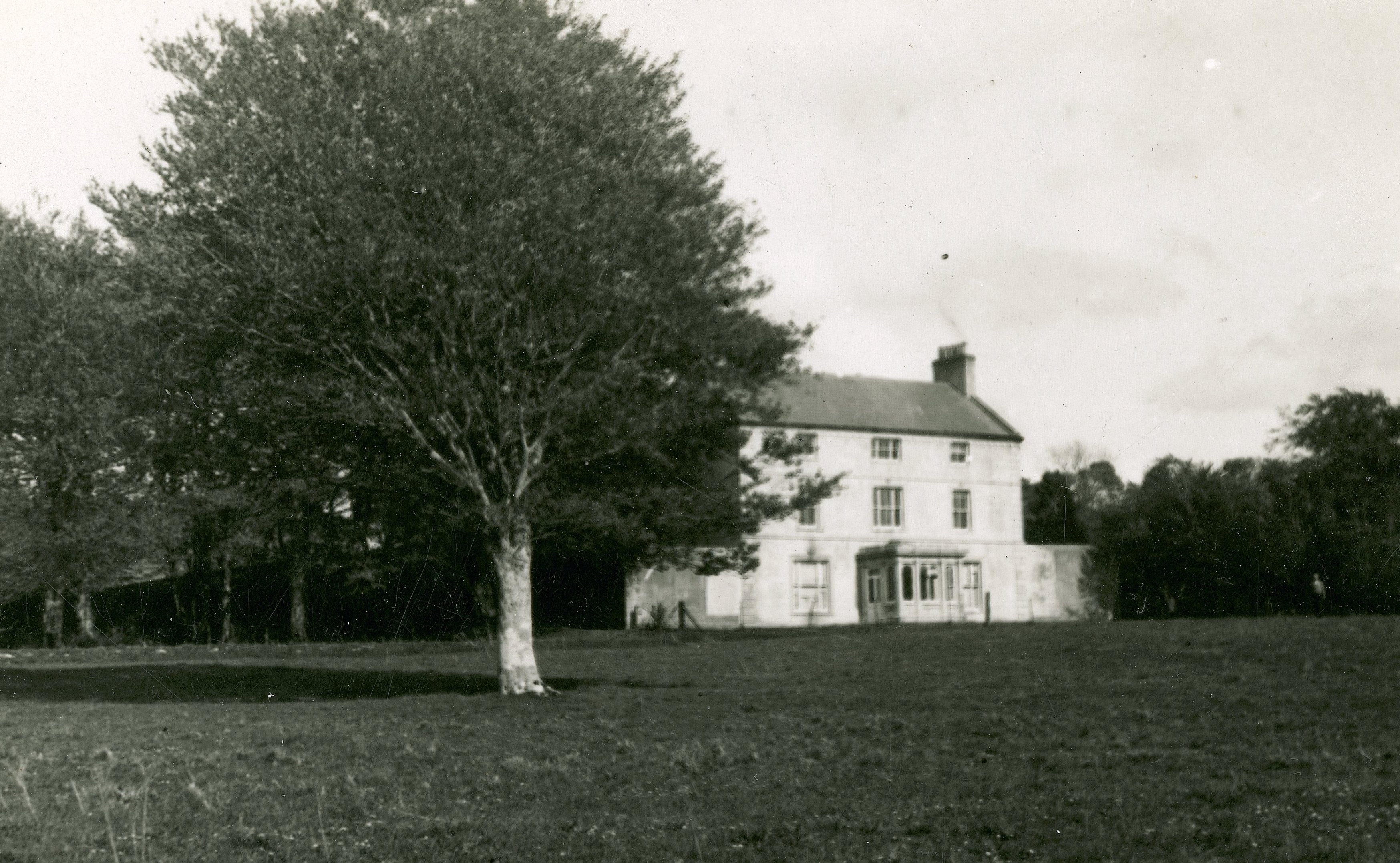
| Dromore | Occupied by Jonas Studdert, third son of Richard Studdert of Clonderalaw, in 1814. In 1795 Jonas married Mary Crowe of Dromore. The home of R. Crowe in 1837. Originally a hunting lodge Dromore became the main residence of the Crowes in the 1830s. The house was sold in 1936 and is now demolished. |
|
| Teernea | Hewitt Bridgeman, Member of Parliament for county Clare, lived here in 1837. By the time of Griffith's Valuation Myles O'Brien was leasing the house from Henry Dwyer. It was then valued at £8.10 shillings. | |
| Curragh House | A house on the Stafford O'Brien estate, the residence of the Faircloth family in the 19th century, valued at £9.10 shillings at the time of Griffith's Valuation. Accidentally burnt in the early 20th century. | |
| Toonagh House | A late 18th century house, occupied by Mr J. O'Brien in 1814 and by C. O'Brien in 1837. By the time of Griffith's Valuation Cornelius O'Brien was leasing the house to Henry William Lucas and it was valued at £19. By the mid 1870s Cornelius O'Brien's son in law William Henry McGrath owned Toonagh. The house was demolished in the mid 20th century. | |
| Ballyline | Weir writes that this house was also known as Millbrook. It was occupied by Henry Butler in 1814 but had reverted back to another branch of the family by 1837 when Austin Butler was the proprietor. Austin Butler held the house in fee at the time of Griffith's Valuation, when it was valued at £15. The representatives of Theobald Butler held the house and 428 acres of untenanted land in 1906. The house was demolished by the Land Commission before the 1940s and the land divided. | |
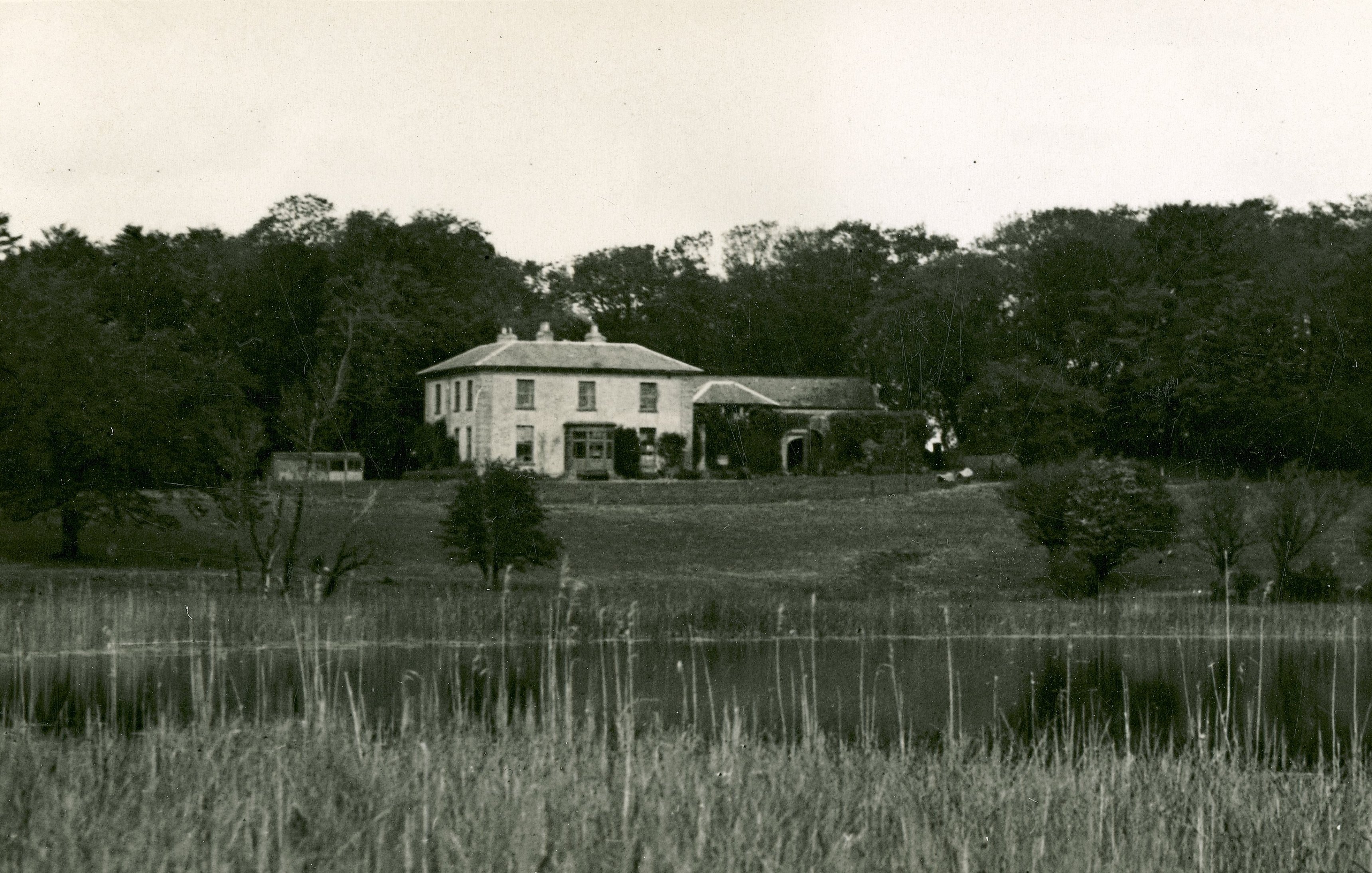
| Ballyallia | An 18th century house, occupied by Andrew Kerin in 1814. It then became the home of Andrew Stacpoole and was owned by William Stacpoole in fee in the mid 19th century when the buildings, which included a house, steward's house, office and gate lodge, were valued at over £41. By the end of the 19th century the Vere O'Briens were living in the house. The house was considerably altered in the 1970s. | |
| Cloonteen | A house in the townland of Cloonteen is named Ballyallia on the first Ordnance Survey map. It was valued at £30 and was held by John Enright in fee at the time of Griffith's Valuation, now a ruin. Weir called this residence Templemaley House, the name by which it is labelled on the 25-inch map of the 1890s. | |
| Larch Hill | A house valued at £20 at the time of Griffith's Valuation and occupied by Captain Charles William Gore, fourth son of Francis Gore of Derrymore. He held the property from Lucinda Finucane. Later leased by the Finucanes to Charles Armstrong, fourth son of William Henry Armstrong of Mount Heaton and New Hall. A new house built in the 1980s now occupies the site. |

|
| Nutfield | A large three storey residence, Nutfield belonged to the Crowe family at the end of the 18th century and up to at least 1814 when it was the residence of Robert Crowe. Wilson refers to it and another house, which he calls Dromquin, as residences of the Crow family. He may be referring to Dromore House. By the mid 19th century Nutfield was the home of Sir Colman O'Loghlen who held it in fee. The buildings were valued at £40. The house is no longer extant. This house was also known as Drumconora. On the Taylor and Skinner map of 1778 it is named Nutgrove. | |
| Cragmoher | A house built in the mid 19th century by Major Charles Washington Studdert eldest son of Jonas Studdert. His son Jonas was born 1857. Burnt in the late 20th century. In 1906 buildings at Killeen were valued at over £17. |
|
| Trinaderry | A house erected in the 1870s as the residence of Andrew Enright. It is labelled Trinaderry House on the 25-inch edition Ordnance Survey map of the 1890s. A house and farm are still extant at this site. |