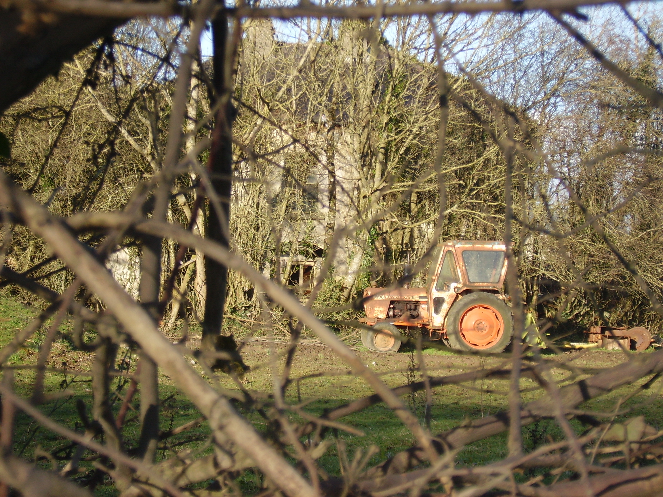
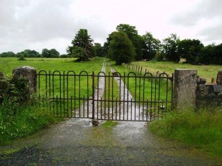
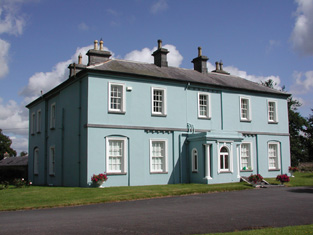
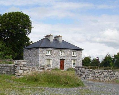
Kilteeven House
Houses within 10km of this house
Displaying 33 houses.
Houses within 10km of Kilteeven House
Displaying 33 houses.
| House name | Description | |
|---|---|---|
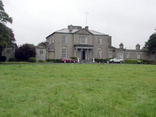
| Mote Park | The home of the Crofton family from the 17th century, valued at £140 in 1906. ''Saunders Newsletter'' dated 17 May 1865 refers to a fire at Mote Park which badly burnt the house. The house was demolished in the 1960s. Roscommon Golf Club occupies part of the original Mote Park demesne. |

|
| Carrowroe Park | The home of the Goff family in the 19th century. Described by Lewis as a substantial and handsome mansion of limestone with a Doric portico, the residence of R. Goff. In the 1850s occupied by the Reverend William Battersby, who held the property from the Earl of Essex. Reverend Battersby was married to Mary Maud Caulfield, a daughter of John Caulfield, Archdeacon of Kilmore. The house was valued at £65. By the 1870s the residence of John Burke and the seat of Lt-Col. Michael A. Burke in 1894. Still extant and offered for sale in 2008 (Irish Times, 5 June 2008). |
|
| Rocksavage | The home of Waldrons and Ormsbys in the 18th century.In 1786 Wilson refers to it as the seat of Mr. Waldron. The residence of Jeffrey French in 1814 and occupied by Mr Smith at the time of the first Ordnance survey and by Samuel Hodson who held it from William Longfield in the 1850s. Occupied by Robert O. Longfield in 1906. A modern house now occupies the site but some old farm buildings still remain. |

|
| Mountplunkett | Built in 1806 by George Plunkett and home of the Plunkett family until the mid 19th century when it became the property of Patrick Grehan. Described in the Crotty sale rental of 1851 as a 'superb mansion' repaired by Mr Crotty at a cost of upwards of £2,000. Grehan held the house, valued at £30, in fee, at the time of Griffith's Valuation. Samuel Richard Prosser lived in Mount Plunkett in the 1860s. The entrance gates are still in use but only walls remain of the house and outbuildings. Robert Adamson was apparently living at Mount Plunkett in the 1870s. |
|
| Ballymurray House | The Crofton family are originally recorded as 'of Ballymurray'. Ballymurray is the next townland east of Mote Demesne. A house at Ballymurray was occupied by Captain E. W. Kelly in 1837 and by Edmund Kelly in the 1850s, who held the house, valued at £9, from the representatives of James Daly. William Curtis was residing in Ballymurray in the 1870s. The property is labelled "Balymurray House" on the 25-inch Ordnance Survey map of the 1890s. It is no longer extant. | |
| Mount Prospect | This house was the residence of John Browne in 1814. Recorded as the seat of Mr Fallon at the time of the first Ordnance Survey in the 1830s but in ruins by the mid 1850s. though a small portion of the house is labelled Mount Prospect on the 25-inch Ordnance Survey map of the 1890s. Small fragments of the building remain at the site. | |
| Churchboro | Occupied by Edward Kelly in 1814, E. Kelly in 1837 and by Patrick Grehan at the time of Griffith's Valuation. The house is no longer extant. |

|
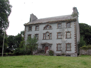
| Scregg | A Kelly home built in 1767, occupied by J.E. Kelly in 1837 and Eliza Kelly in the 1850s. In the sale rental of 1856 the house is described as a respectable mansion, 3 stories high with basement and attic stories and a view of the Shannon River. Occupied in 1906 by the representatives of Henry Potts. The house is extant but no longer lived in. It is currently (2009) being restored with support from the Irish Georgian Society, see http://www.igs.ie/Programmes/Conservation-Grants/Scregg-House.aspx |
|
| Sandfield House | Wilson notes this house as the seat of Mr. Sandys in 1786. The residence of Robert Sandes in 1814 and occupied by Bernard Reilly and valued at £3.10s at the time of Griffith's Valuation. A house is still extant at this location. | |
| Kellybrook | Wilson records this house as a Kelly residence in 1786. The seat of Denis Kelly in the 1830s and of Jane Kelly in the 1850s who held the property from Esther Dillon and the representatives of Maria Boswell. The house was valued at £3. Still occupied by a family named Kelly. |
|
| Galeybeg | Occupied by Mr Bart Purdue in 1814 and in the 1830s described as a gent's seat belonging to Mr Bond with a neat demesne attached. The sale rental of 1856 states that it was built by the Reverend James Bond. In the 1850s held by Richard Bond in fee from the Court of Chancery and described as a herd's house with office. The home of Benjamin Greene in 1906. Occupied until the late 20th century, now derelict. |
|
| Beechwood | A residence of the Hughes family in the 18th century. The sale rental of 1859 states that Beechwood was for many years the residence of the late Mr Ferrall. Daniel Ferrall of Beechwood was issued with a game licence in 1822. Occupied by Daniel Irwin in the 1850s when the house was valued at £40, by the Tolers in the 1880s and by Clare M. Nolan in 1906. Norton states that the Irwin brothers were nephews of Daniel Ferrall. Beechwood is no longer extant. |
|
| Holywell | Originally a Gunning home that passed to the Blakeneys by marriage. In 1786 Wilson mentions it as the seat of Charles Blakeney. Occupied by C. W. Blakeney in 1837 and by Henry Smyth in the 1850s who held the property from John Goodall. The property is no longer extant. | |
| Essex Lawn | Built after the First Ordnance Survey on part of the estate of the Earl of Essex, this house was occupied by John Kelly in the 1850s when it was valued at £18 10s. It is still extant. |
|
| Derrane House | The home of the Corr family in the 19th century, Henry Corr is recorded as living at "Durham" in 1814. Henry "Gorr" was residing in a property here valued at £12 at the time of Griffith's Valuation. It is recorded as "Derrane House [in ruins]" on the 25-inch Ordnance Survey map of the 1890s and very little trace remains of it now. | |
| Roxborough | Wilson, writing in 1786, refers to Roxborough as the seat of "Mr. Irvine". The residence of John Irwin in 1814 and of A. Brown in 1837. In the 1850s occupied by John Gaynor, when the house was valued at £20. The property is now a ruin. | |
| Drumdaff | Charles Croghan, a farmer, lived at Drumduff in 1749. Home of the Digby family in the 19th century. Held in fee by George Digby at the time of Griffith's Valuation when the buildings were valued at £17.It is still extant and maintained. |

|
| Lisbride | Occupied by John B. Purdon in 1814 and in 1822 by Arthur Browne. Patrick Duignan was resident at the time of Griffith's Valuation, when the house was valued at £12. A house still exists at the site. | |
| Hazelbrook | The residence of the Reverend Oliver Carey in 1814 and in the 1830s of Robert Blakeney. At the time of Griffith's Valuation occupied by Joseph A. Holmes and in 1906 by the representatives of John Neilan. Still extant but not occupied. | |
| Ballymartinbeg | At the time of Griffith's Valuation Jane Plunket held the house, offices and cornmill valued at £16 from the representatives of Gunning Plunket. Occupied by Martin McDonnell in 1906 and valued at £11. A house at the site has been recently renovated. |
|
| Englishtown (Ballygalda House) | A Mitchell family home from the mid 18th century. Occupied by William N. Reynolds at the time of Griffith's Valuation who held from George G. Battersby. The house was valued at £4.It is labelled Englishtown on the 1st edtion Ordnance Survey map but as Ballygalda House on the later 25-inch edition. A house and substantial farm are still extant at the site. | |
| Carrowmore | Carrowmore was occupied by John Davis at the time of Griffith's Valuation, when it was valued at £8 and leased from the Gunning estate. It is labelled Carrowmore House on the 25-inch Ordnance Survey map of the 1890s. A house still exists at the site. | |
| Fairymount | The home of Edward Mills in 1814. In 1828 Edward Mills of Fairymount was a member of the Grand Panel of county Roscommon. Residence of Mr Lyster at the time of the first Ordnance Survey. By the time of Griffith's Valuation the largest house in the townland of Fairymount was valued at £1.15s, leased by Anne Lyster to Michael Connolly. | |
| Mullymucks/Fortview | Built post 1838, though the National Inventory of Architectural Heritage suggests it is a modified 18th century house. Occupied by Francis Lyng in the 1850s, when it was valued at £24. It is still extant and now known as Fortview House. |
|
| Munsborough House | Built post 1838 and occupied by Edward Pearse in the 1850s, when it was valued at £20. Extensive buildings are shown at the site on the 25-inch edition Ordnance Survey map of the 1890s, labelled Munsborough House. A house and large farm are still extant at the site. | |
| Ballybride | James O'Farrell was leasing over 180 acre and a herd's house from Louisa Pelly at Ballybride, barony of Roscommon, at the time of Griffith's Valuation. | |
| Ballagh | In 1814 James O'Connor was residing at Ballagh. Described as a good dwelling house at the time of the first Ordnance Survey. Occupied by Denis O'Conor in the 1850s, held from Theobald Dillon and valued at £6. In 1906 James D. O'Connor occupied Ballagh, valued at £17. It is no longer extant. | |
| Martinstown | In 1786 Wilson refers to Martin's-town as the seat of Mr. Davys. The residence of George Davis in 1814 and of Mr Davis in the 1830s, apparently held from the Digby family. By the time of Griffith's Valuation Ballymartinmore was in the possession of George Digby and a vacant house valued at £4 was held by Edward Flynn. The house is no longer extant. |

|
| Grove | This house, near Roscommon town, is named Bob's Grove on the Taylor and Skinner map, the residence of Ormsby esquire. Wilson also refers to it as the seat of Mr. Ormsby in 1786. Occupied by Christopher Davies in 1814. The house is labelled Grove on the1st and 25-inch edition Ordnance Survey maps. | |
| Durham Lodge | Elizabeth Sandys advertised for sale "Durham Lodge" and 39 acres in July 1854. The Sandys house was valued at £3 in the 1850s and in 1906. This house was held in fee by William "Sands" at the time of Griffith's Valuation. It is not named on the 1st edition Ordnance Survey map but is shown as Durham Lodge on subsequent editions. A farm is still extant at the site. | |
| Rathcline House | St. George Johnston was leasing this property from Colonel Henry White’s estate at the time of Griffiths Valuation in the early 1850s when it was valued at almost £38. Earlier, in 1837, Lewis referred to it as the seat of L. White. The National Built Heritage Service suggests the current house was built c.1820 though there is evidence to suggest there was an earlier house, also owned by the White family, at the site in the 1770s. Rathcline House served as a convent for the Sisters of Mercy in the mid-20th. It is still extant. |
|
| Barnacor Mill | John Costello was leasing this property from Luke White’s estate at the time of Griffiths Valuation, when it was valued at £28. Some buildings still remain at the site. | |
| Cordara House | By the end of the 19th century Cordara House had been constructed at a different site in Newpark townland. It has since been demolished though some estate buildings remain at the site. |
|