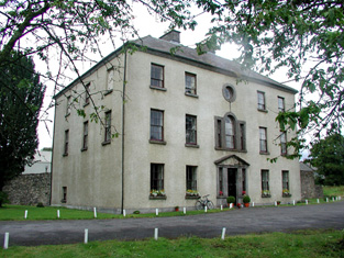
Lough Key House
Houses within 5km of this house
Displaying 25 houses.
Houses within 5km of Lough Key House
Displaying 25 houses.
| House name | Description | |
|---|---|---|
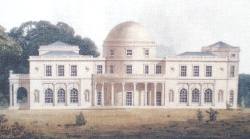
| Rockingham | Sir Robert King, Viscount Lorton, built Rockingham House around 1810 and the family moved there from King House in Boyle. At the time of Griffith's Valuation Rockingham was valued at £180. In 1903 Rockingham became the county residence of the Lord Lieutenant Lord Dudley. It was destroyed by fire in 1957 and subsequently demolished. Only some of the servants' tunnels as well as other estate buildings remain. The site is now occupied by Lough Key Forest Park. |
|
| Estersnow Glebe | At the time of Griffith's Valuation the Ecclesiastical Commissioners were leasing a house at Cavetown valued at £10 to Rev. Frederick Hamilton. It is described as "a good glebe house, the residence of the incumbrant of Estersnow" at the time of the 1st Ordnance Survey. It is still extant and occupied. | |
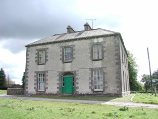
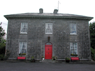
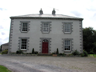
| Ardcarne House | At the time of Griffith's Valuation John Hackett was leasing Ardcarne House, valued at £25, from Viscount Lorton's estate. The house is still extant and used as a farmhouse. |
|
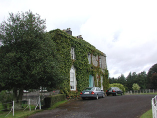
| Glencarne House | At the time of Griffith's Valuation Samuel Handy was leasing a house valued at £18 at Ardcarne, barony of Boyle, from Viscount Lorton's estate. Glencarne is now a guesthouse. |
|
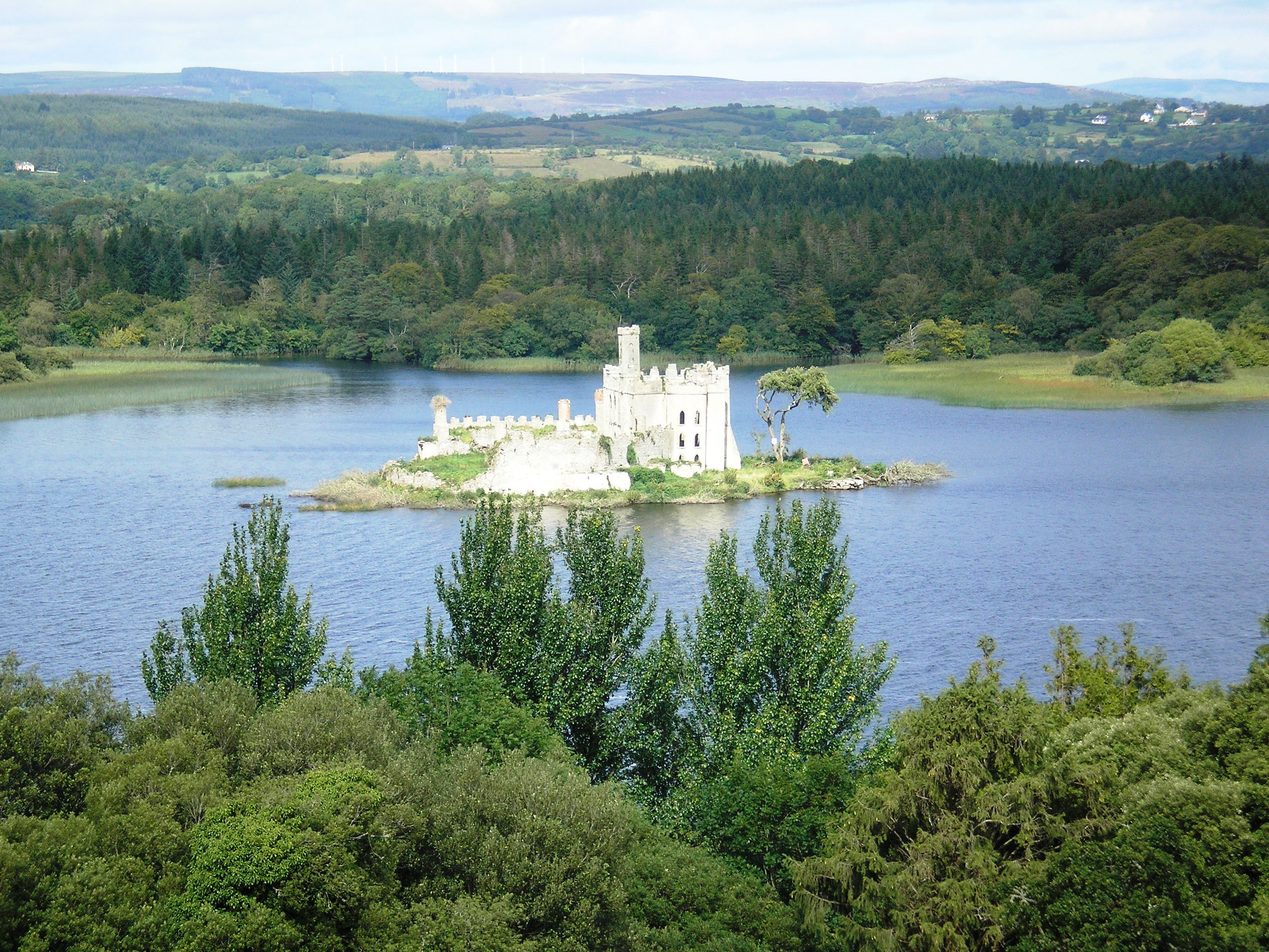
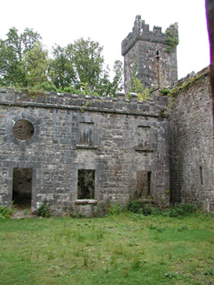
| Castle Island | Also known locally as the Rock of Lough Key, at the time of Griffith's Valuation Viscount Lorton's estate owned a house on Castle Island valued at £14. The original building on the island was a medieval stronghold of the McDermott family to which additions were made in the early 19th century. Renovation work was taking place on these buildings in 2007. |
|
| Ardcarn Glebe | At the time of Griffith's Valuation Viscount Lorton was leasing the Glebe House in Ardcarn parish to Rev. George Griffith when it was valued at £12. It is still extant and is part of a large farming enterprise. |
|
| Grevisk | At the time of Griffith's Valuation Thomas Phibbs Peyton was leasing a house at Grevisk, valued at £10, along with 100 acres, from Viscount Lorton's estate. The Census of 1749 recorded Grevisk as the home of John Nesbit. It is still extant. | |
| Knockvicar | At the time of Griffith's Valuation Charles J. Peyton was leasing a house at Knockvicar, parish of Ardcarn, valued at £15 to Edward Jones. Lewis records the house as the seat of C.J. Peyton in 1837. In 1814 it was the seat of Randal Peyton. | |
| Oakport | Oakport was the home of the Reverend William French, fourth son of John French of French Park, in the early 18th century. At the time of Griffith's Valuation, Oakport House, the property of Thomas William Goff, is recorded as "unoccupied". A house is still extant at the site. | |
| Mount Erris | At the time of Griffith's Valuation William Duckworth was leasing this house valued at £26 from Viscount Lorton's estate. There is still an inhabited house at this site. |
|
| Tangier | Caleb Robertson is recorded as occupying the house known at the time of the first Ordnance Survey. He is noted as the immediate lessor at the time of Griffith's Valuation though the house was unocciped and valued at £28. Tangier House was occupied by Harward O'Farrell, a doctor, in the second half of the 19th century. His third son, Sir George Plunkett O'Farrell, was granted arms in 1909. A house is still extant at the site. | |
| The Warren | Caleb Robertson is recorded as the lessor of a property in the townland of Warren or Drum at the time of Griffith's Valuation. It was valued at £25 and leased to a Captain Butler. A house at this site is labelled The Warren on the 25-inch map of the 1890s and a house still exists there. | |
| Millmount | Viscount Lorton was leasing a house valued at £18 at Macmoyne, parish of Boyle, to Nicholas Mulhall, at the time of Griffith's Valuation. This may be the still extant Millmount House, associated with the milling complex. |
|
| Moylurg House | In 1837 Lewis records Moylurg house as the seat of the Dick family. Rev. William Robertson was leasing a property valued at £25 to John Johnston, at Clogher, parish of Eastersnow, at the time of Griffith's Valuation. This appears to be Moylurg House which is still extant. Moylurg was the home of Major Henry Taaffe Ferrall in the 1870s. |
|
| Havarine Cottage | Anna Maria Fry was leasing a house valued at £11 from Lord Lorton's estate at Tullyvohaun, barony of Boyle, at the time of Griffith's Valuation. At the time of the first Ordnance Survey Havarine Cottage, at Tullyvohaun, was described as a ''gentleman's seat', the residence of Mrs. Fry. | |
| Frybrook House | Frybrook House was built by Henry Fry, who came to Boyle in 1742, and established a weaving industry in the town. It is still extant. In 2025 it was offered for sale. |
|
| King House | King House was built between 1720-1740 by Sir Henry King. In 1786 Wilson wrote "the Earl of Kingston has a very fine house at Boyle, situated near the ruoins of an ancient abbey". Following a fire in 1788 the King family vacated the house and moved to Rockingham on the shores of Lough Key. King House was used as a military barracks until the 1960s. It is now in the ownership of Roscommon County Council and is open to the public. |
|
| Carrickard House | At the time of Griffith's Valuation, Charles Peyton was leasing a house at Keeloges, valued at £25, from Lord Lorton's estate. |
|
| Riversdale House | John R. French was leasing a house valued at £25 at Kilateasheen from the Ecclesiastical Commissioners at the time of Griffith's Valuation. There is no substantial house marked on the 1st edition OS map. This house is still extant and known as Riversdale House. |
|
| Ellesmere | Harloe Powell was leasing a house valued at £18 at Ardcarn, barony of Boyle, from Viscount Lorton's estate, at the time of Griffith's Valuation. This house is still extant and occupied. |
|
| Abbey View House | Morgan Crofton, agent to Lord Lorton, was residing here at the time of the first Ordnance Survey. At the time of Griffith's Valuation it was occupied by Caleb Robertson and valued at £34. A house is still extant at Abbey View. |
|
| Cavetown | In 1786 Wilson notes Cavetown as the seat of the Rev. Dean Mahon and the Reverend Arthur Mahon resided there in 1814. At the time of the first Ordnance Survey a ''gentleman's seat of two stories'' is noted in Cavetown. Guy Lloyd is recorded as the proprietor. This may be the property, valued at £5, leased from the Lloyd estate by Geo. Laird at the time of Griffith's Valuation. There are buildings still extant at this site. |
|
| Rushfield | At the time of the first Ordnance Survey Mr. A. Irwin is noted as the occupier of one of two ''gentlemen's seats' at Tullyvohaun, barony of Boyle. In 1814 it was the residence of John Irwin. This property was valued at £8 and was occupied by William Phibbs at the time of Griffith's Valuation. A substantial farm still exists at the site. | |
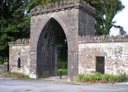
| Drum Lodge | One of the many surviving gatelodges on the Rockingham Demesne. |
|
| Cloontykilla Castle | This building was constructed after the publication of the first Ordnance Survey Map. It appears to have functioned as a shooting/fishing lodge for the King estate. It is now a ruin. |
|