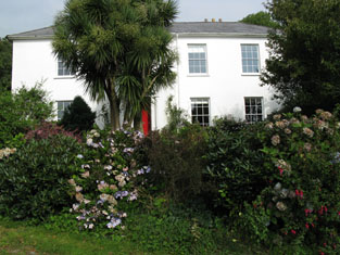
Derreeny House
| Estate(s) | |
|---|---|
| Townland | Derreeny |
| Civil Parish | Caheragh |
| PLU | Skibbereen |
| DED | Woodfort 311 |
| County | Cork |
| Barony | West Carbery (West) |
| Description | This property was built sometime after the 1st edition Ordnance map was published. In the 1850s Samuel Townsend held a property in fee at Derreeny, valued at £6 10s. Labelled Derreeny House on the 25-inch Ordnance Survey map, it is still extant and occupied. |