North (Kilbride)
The Norths were Cromwellian settlers in county Westmeath and originally resided at Newcastle in the parish of Clonfad. In 1786 John North of Whitewell married Anne daughter of David Bomford of Gallow, Kilcock, county Meath and they had three sons - David who married Catherine Pim, Isaac who assumed the name of Bomford and John who married Ellen Barbour. At the time of Griffith’s Valuation (publ. 1854) members of the North family were immediate lessors in the parishes of Kilbride (John), Moylisher (David) and Rahugh (Rev Joseph). In the mid-1870s these family members - Mrs Emily, John, Rev Joseph and Joseph P owned 368, 305 281 and 463 acres respectively in county Westmeath. A very detailed history of this family is given at this site http://www.bomford.net/IrishBomfords/Chapters/Chapter16/norths_of_ireland.htm
Associated Families
Houses
| Name | Townland | Civil Parish | PLU | DED | Barony | County | Map Ref | |
|---|---|---|---|---|---|---|---|---|
| Far View House | Castlelost West | Castlelost | Mullingar | Clonfad | Westmeath |
OSI Ref: N447405
OS Sheet: 33 Discovery map: 48 |
|
|
| The Cottage | Gallstown | Castlelost | Mullingar | Gaybrook 75 | Westmeath |
OSI Ref: N478422
OS Sheet: 33 Discovery map: 48 |
||
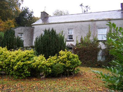
| Guilford House | Guilford or Davidstown | Clonfad | Mullingar | Clonfad 100 | Westmeath |
OSI Ref: N407393
OS Sheet: 33 Discovery map: 48 |
|
|
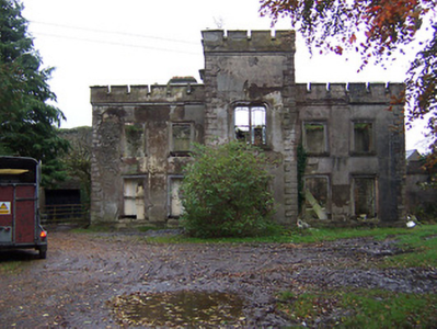
| Newcastle | Newcastle | Clonfad | Mullingar | Ballykilmore 96 | Westmeath |
OSI Ref: N422395
OS Sheet: 33 Discovery map: 48 |
|
|
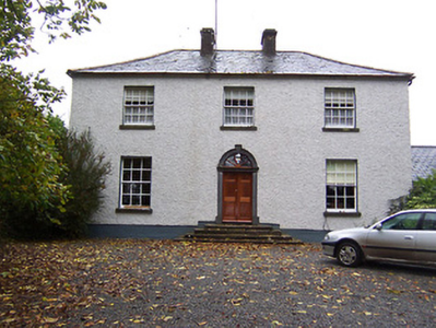
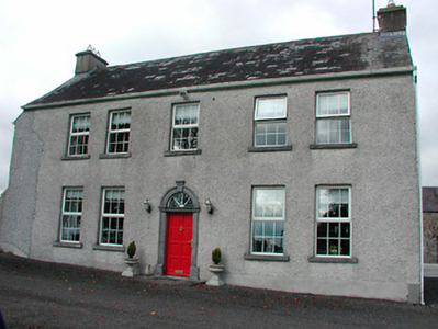
| Kilbride | Kilbride | Kilbride | Mullingar | Carrick 98 | Westmeath |
OSI Ref: N441439
OS Sheet: 33 Discovery map: 48 |
|
|
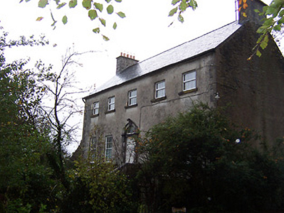
| Whitewell House | Whitewell | Kilbride | Mullingar | Carrick 98 | Westmeath |
OSI Ref: N447437
OS Sheet: 33 Discovery map: 48 |
||
| Tyrrellstown | Tyrrellstown | Moylisker | Mullingar | Belvidere 80 | Westmeath |
OSI Ref: N444463
OS Sheet: 26 Discovery map: 48 |
|
Map of Estate Houses
Click on the markers to view more details about each house.
Contemporary printed sources
- HUSSEY DE BURGH, U. H. ''The Landowners of Ireland. An alphabetical list of the owners of estates of 500 acres or £500 valuation and upwards in Ireland''. Dublin: Hodges, Foster and Figgis, 1878. [available online at www.askaboutireland.ie] : 340
- PARLIAMENTARY PAPERS. ''Return of owners of land of one acre and upwards, in the several counties .... in Ireland''. HC 1876, LXXX: 85
- TAYLOR, George & SKINNER, Andrew. ''Maps of the Roads of Ireland, surveyed in 1777 and corrected down to 1783''. Facsimile of 2nd edition. Shannon: Irish University Press, 1969: 250 (Newcastle)
- ''GRIFFITH'S VALUATION OF IRELAND'[Primary Valuation of Tenements]', 1850-1858. : Mullingar Union, 126 (Castlelost West); 142 (Whitewell); 149 (Tyrrellstown)
- LEWIS, Samuel. ''A Topographical Dictionary of Ireland''. London: S. Lewis & Co., 1837: I, 300 (Farview); II, 56 (Whitewell)
- LEET, Ambrose. ''A directory to the market towns, villages, gentlemen's seats, and other noted places in Ireland''. Dublin: Printed by B. Smith, 1814 : 227 (Kilbride)