Grier
At the time of Griffiths Valuation in the 1850s, Robert and John "Greer" were among the principal lessors in the parish of Clonbrony, barony of Granard. In the 1870s Edward Grier of Hillsbrook, Ballinalee was recorded as the owner of just over 160 acres in the county.
Associated Families
Houses
| Name | Townland | Civil Parish | PLU | DED | Barony | County | Map Ref | |
|---|---|---|---|---|---|---|---|---|
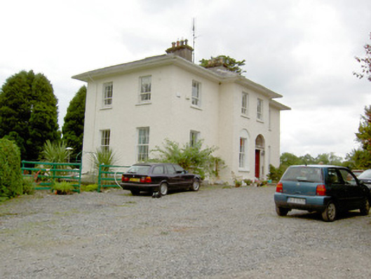
| Garvagh House | Garvagh | Clonbroney | Granard | Currygrane | Longford |
OSI Ref: N221790
OS Sheet: 9 Discovery map: 41 |
||
| Vicarsfield | Vicarsfield Glebe | Clonbroney | Granard | Ballinalee |
OSI Ref: N221800
OS Sheet: 9 Discovery map: 41 |
|
Map of Estate Houses
Click on the markers to view more details about each house.
Contemporary printed sources
- ''GRIFFITH'S VALUATION OF IRELAND'[Primary Valuation of Tenements]', 1850-1858. : Granard Union, p.45 (Garvagh)
- LEWIS, Samuel. ''A Topographical Dictionary of Ireland''. London: S. Lewis & Co., 1837: Vol.I pp.350-351.(Clonbroney)