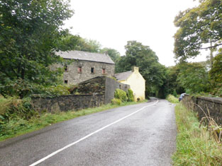
Sullivan (West Carbery)
William Sullivan of Bandon owned over 700 acres in county Cork in the 1870s.
Associated Families
Houses
| Name | Townland | Civil Parish | PLU | DED | Barony | County | Map Ref | |
|---|---|---|---|---|---|---|---|---|
| Carrigfadda House [Town View] | Carrigfadda | Abbeystrowry | Skibbereen | Skibbereen Rural 309 | West Carbery (East) | Cork |
OSI Ref: W125324
OS Sheet: 141 Discovery map: 89 |
|
| Kilnagross | Beanhill South | Kilnagross | Clonakilty | Kilnagross 49 | East Carbery (East) | Cork |
OSI Ref: W399444
OS Sheet: 122 Discovery map: 86 |
|
| Gortahorna House | Barleyfield | Rathclarin | Bandon | Rathclarin 12 | East Carbery (East) | Cork |
OSI Ref: W507480
OS Sheet: 123 Discovery map: 86 |

|
| Hill House (Bandon) | Coolfadda | Kilbrogan | Bandon | Kilbrogan 4 | Kinalmeaky | Cork |
OSI Ref: W483555
OS Sheet: 110 Discovery map: 86 |
Map of Estate Houses
Click on the markers to view more details about each house.
Archival sources
- Draft pedigree of Sullivan of Killnagross and Sunville, Co. Cork and Leader (earlier Sullivan), 1724 -- 1899.GO Ms.811(17) ; National Library of Ireland
Contemporary printed sources
- ''GRIFFITH'S VALUATION OF IRELAND'[Primary Valuation of Tenements]', 1850-1858. : West Carbery Barony (East): 2 (Carrigfadda)
- HUSSEY DE BURGH, U. H. ''The Landowners of Ireland. An alphabetical list of the owners of estates of 500 acres or £500 valuation and upwards in Ireland''. Dublin: Hodges, Foster and Figgis, 1878. [available online at www.askaboutireland.ie] : 435
- ''GRIFFITH'S VALUATION OF IRELAND'[Primary Valuation of Tenements]', 1850-1858. : East Carbery (East) Barony: 116 (Beanhill South), 124 (Barleyfield)
- PARLIAMENTARY PAPERS. ''Return of owners of land of one acre and upwards, in the several counties .... in Ireland''. HC 1876, LXXX: 135
- LEWIS, Samuel. ''A Topographical Dictionary of Ireland''. London: S. Lewis & Co., 1837: Kilnagross Parish, Vol.II, 193.

