Hilliard
In the 1870s, Henry Hilliard, together with Oliver Stokes, were the proprietors of over 1000 acres in county Kerry. At the time of Griffith's Valuation, he was leasing lands from the Colthurst estate in the parish of Annagh. In the 1830s the Ordnance Survey Name Books noted that John Hilliard was agent for Anthony Denny, then resident in England and the proprietor of townlands in the parish of Ardfert.
Associated Families
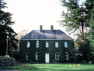
Houses
| Name | Townland | Civil Parish | PLU | DED | Barony | County | Map Ref | |
|---|---|---|---|---|---|---|---|---|
| Ballyhorgan South | Ballyhorgan South | Dysert | Listowel | Ballyhorgan | Clanmaurice | Kerry |
OSI Ref: Q924296
OS Sheet: 16 Discovery map: 71 |
|
| Billeragh House | Billeragh | Kilmoyly | Listowel | Listowel Rural 121 | Clanmaurice | Kerry |
OSI Ref: Q970309
OS Sheet: 16 Discovery map: 63 |
|
| Tubrid House | Tubrid More | Ardfert | Tralee | Tubrid 136 | Clanmaurice | Kerry |
OSI Ref: Q809211
OS Sheet: 21 Discovery map: 71 |
|
| Hillsborough Cottage | Commons West | Ardfert | Tralee | Clogherbrien 171 | Clanmaurice | Kerry |
OSI Ref:
OS Sheet: 20 Discovery map: 71 |
|
| Ballygarran House | Ballygarran | Ballynahaglish | Tralee | Ballynahaglish 169 | Trughanacmy | Kerry |
OSI Ref: Q763167
OS Sheet: 28 Discovery map: 71 |
Map of Estate Houses
Click on the markers to view more details about each house.
Archival sources
- Extracts from registers of Cloghane, Killiny, Listrim and Ballinahaglish parishes, relating to Hilliard family, 1719-1752. M.3604. ; National Archives of Ireland
Contemporary printed sources
- LEWIS, Samuel. ''A Topographical Dictionary of Ireland''. London: S. Lewis & Co., 1837: Vol.I, 631 (Finuge Parish)
- LEET, Ambrose. ''A directory to the market towns, villages, gentlemen's seats, and other noted places in Ireland''. Dublin: Printed by B. Smith, 1814 : 44 (Ballyhorgan), 69 (Billeragh)
- ''GRIFFITH'S VALUATION OF IRELAND'[Primary Valuation of Tenements]', 1850-1858. : Clanmaurice Barony: 10 (Commons West), 13 (Tubrid), 122 (Billeragh)
- ORDNANCE SURVEY NAME BOOKS County Kerry: Vol.I, Ardfert Parish, 97, Ballynahaglish Parish, 276.